Escape

There is something about an interesting map donation to the Oxfam bookshop which seems to get all sorts of volunteers interested.

And recently we have had some more than usually volunteer-captivating ones.

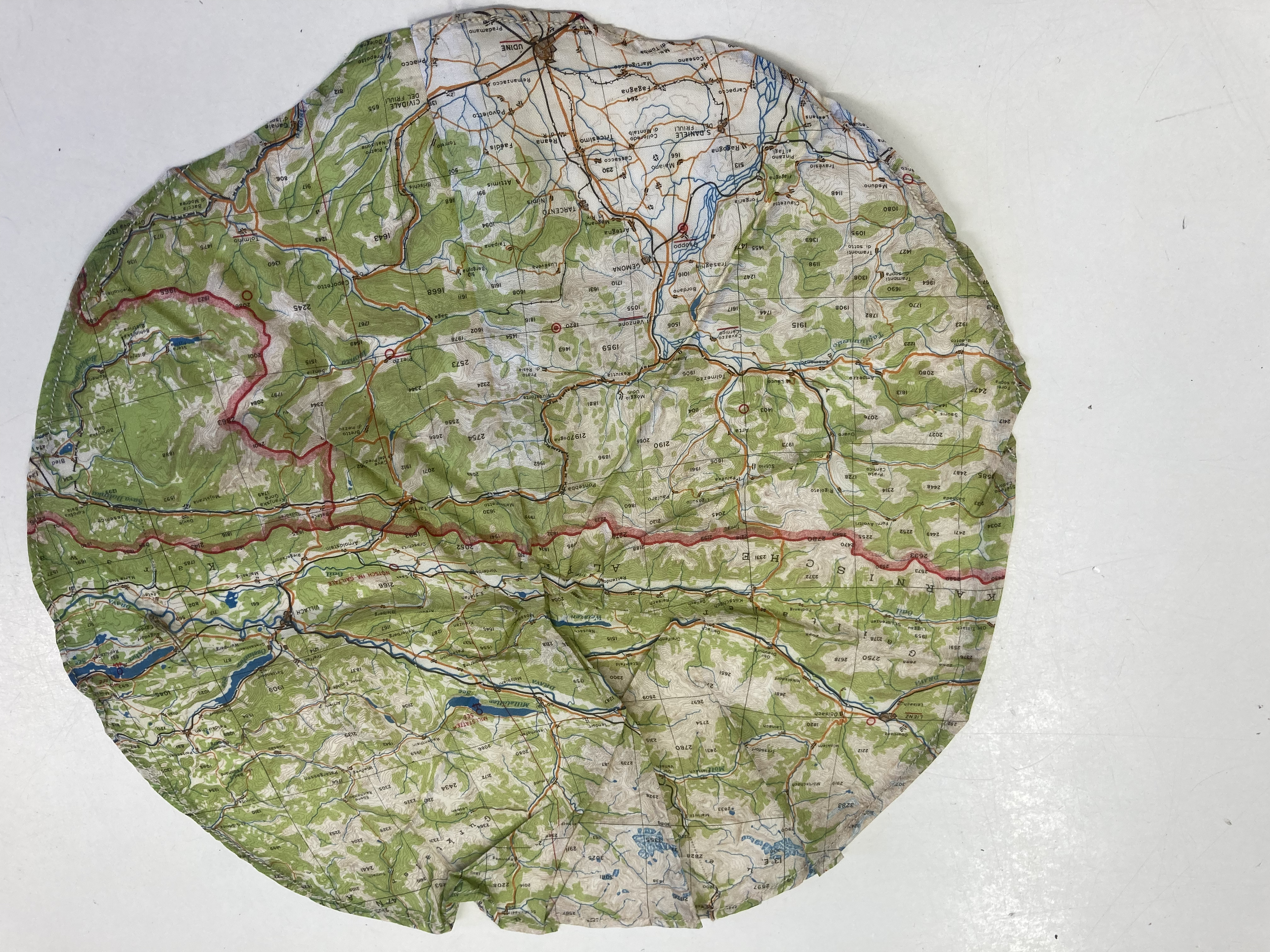
In an envelope in the back of the book, a colleague found these.

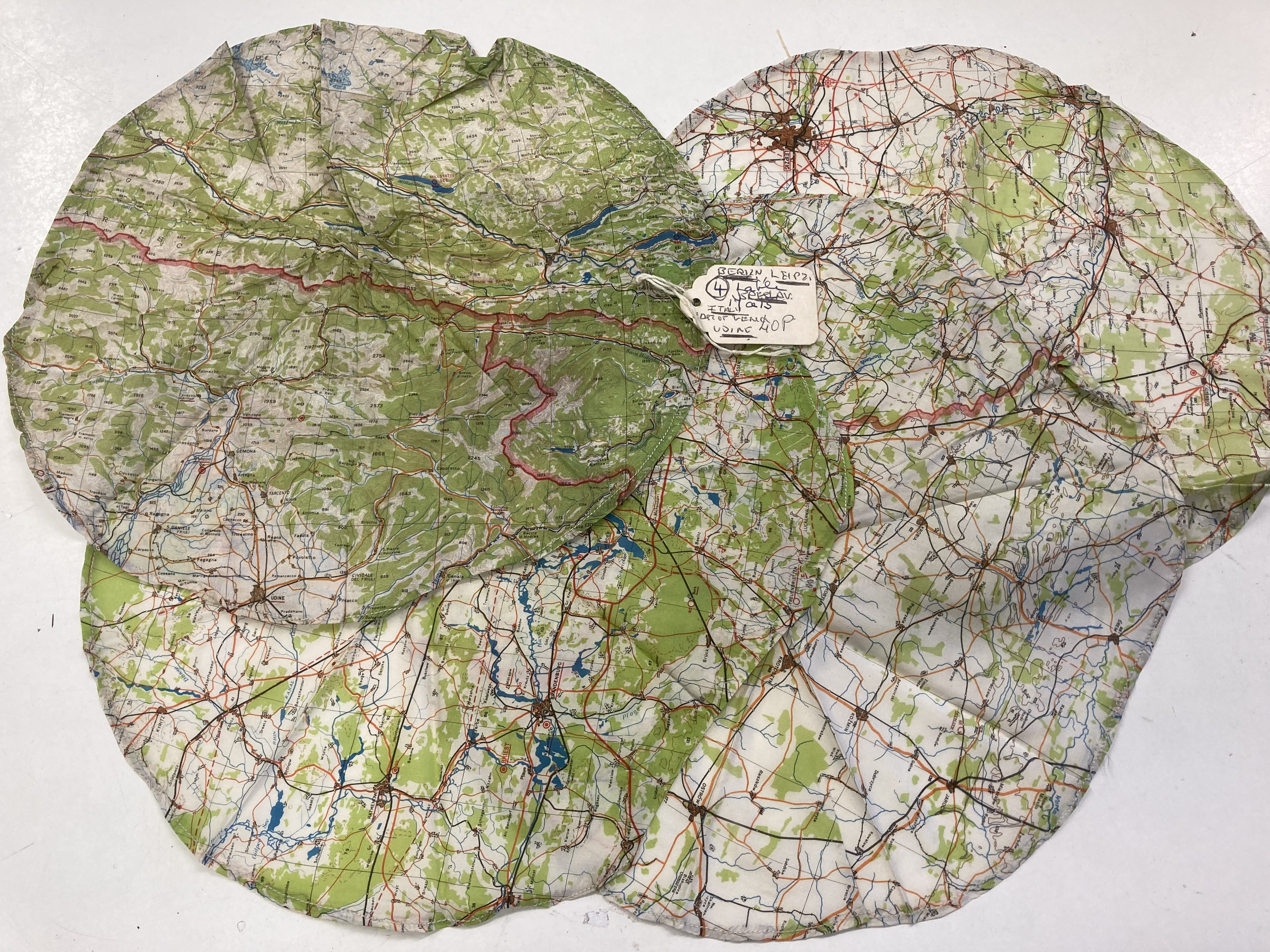
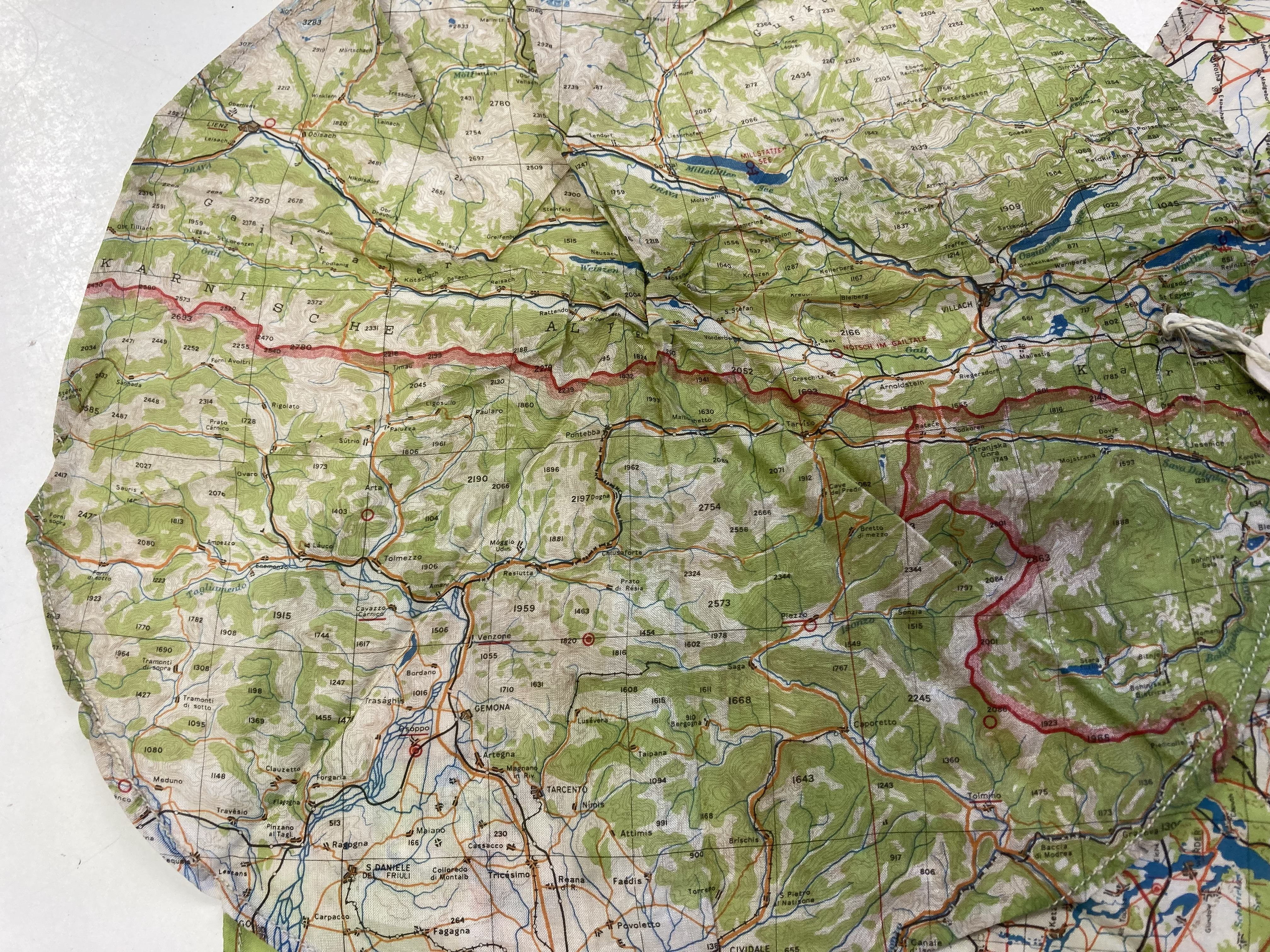
They are the remnants of escape maps.

One of them includes Berlin – so a brave person who went in there.

In case you don’t know, and we didn’t, maps were printed on parachute silk and/or rayon fabric and given to people making their way into ( and hopefully out of ) enemy territory in WW II.

(And if you will excuse me being rather clumsy, they are a nice escape from someone’s house clearance of less than riveting books. Of course, we love all the books donated but you know, now and then……)

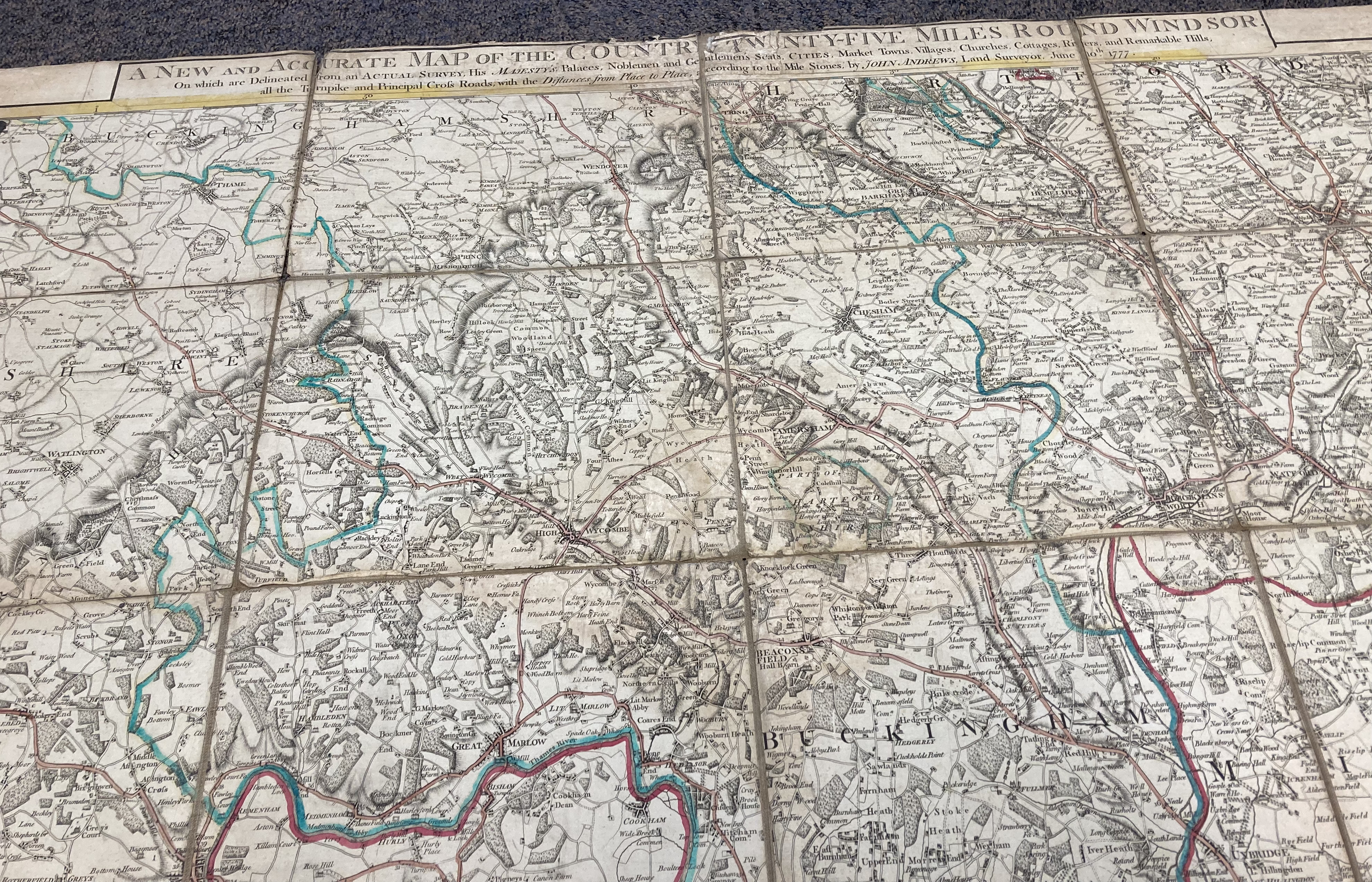
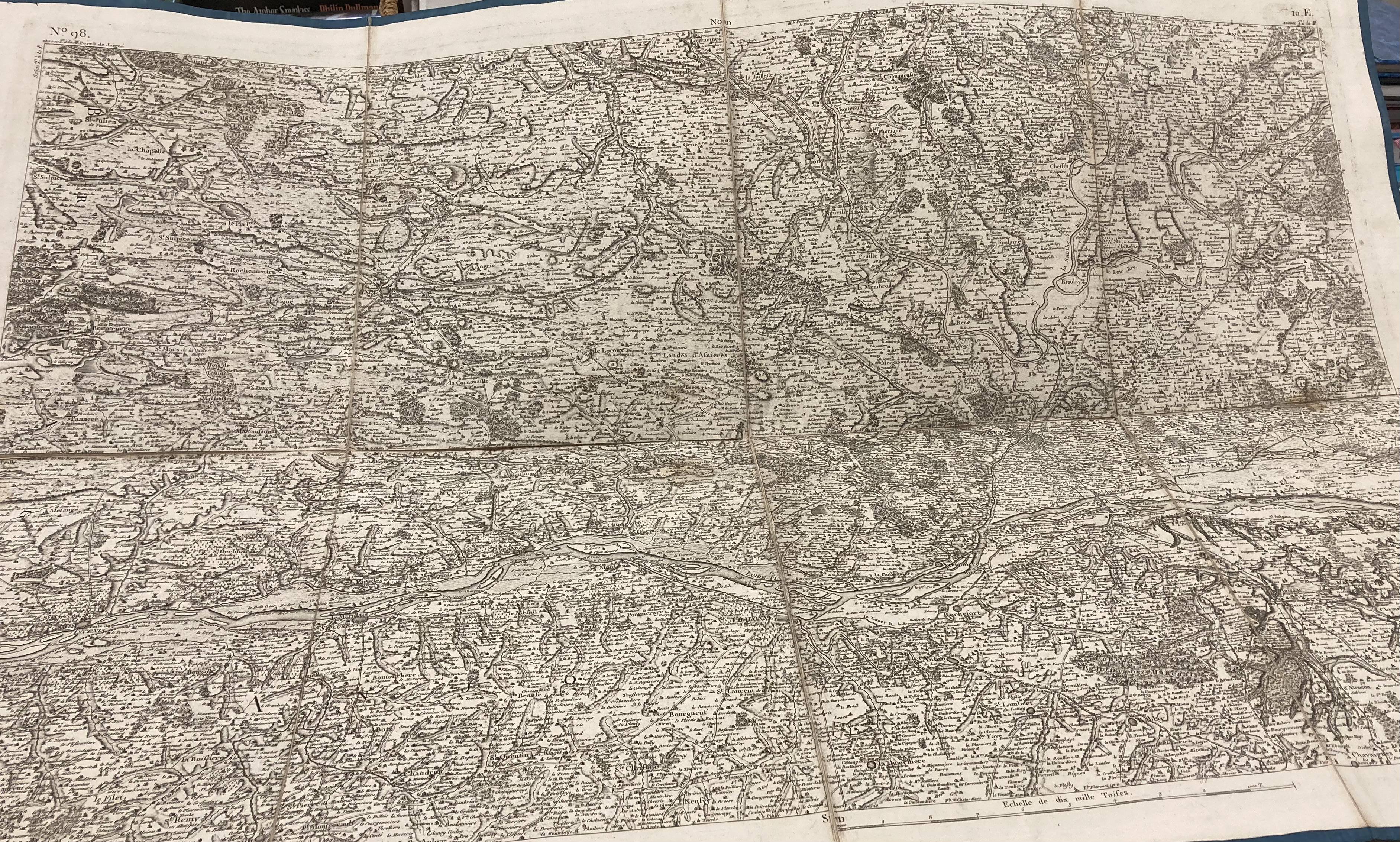
Originally, they would have been larger and square and the fact that someone has cut them down to make, what? A small place mat? has rendered them a lot less valuable than they would have been.

The printing is amazingly clear and of course the fabric meant you could scrunch it up to nothing, hide it in your pocket, make into a hatband when in disguise, put into a slit in the lining of a jacket…. ( both true apparently.)

And there was none of that difficult, time-consuming folding and unfolding of a linen or paper map with which anyone whose been on a long walk in familiar territory, leave alone enemy territory, is all too familiar.

Courtesy, as ever, from Wikipedia:

During World War I Australians produced an escape map for use in July 1918 by prisoners in the German Holzminden POW Camp, sections of map were sewn into the clothing of prisoners who escaped via a tunnel to Allied territory.”

Some American intelligence offices visited the UK in 1942 to be briefed on the British efforts in escape and evasion techniques and equipment. 

The British MI9 gave the Americans a book or manual called “Per Ardua Libertas” to take back to the US. Published in this manual were examples of each cloth escape and tissue escape map that the British had produced. 

After this meeting with the British, the United States began to produce its own escape maps. Most of the American maps supplied by the Army Map Service from World War II were actually printed on rayonacetate materials, and not silk.

However, because of the silky texture of the materials, they were referred to by the more familiar textile name.

During WWII hundreds of thousands of maps were produced by the British on thin cloth and tissue paper. The idea was that a serviceman captured or shot down behind enemy lines should have a map to help him find his way to safety if he escaped or, better still, evade capture in the first place.

Many of these maps were also used in clandestine wartime activities.

Apparently,  35,000 servicemen and men and women on secret missions escaped safely during WW II and it is estimated half of them used some form of escape or evasion map to do it.

But it wasn’t just servicemen ( and maybe women on secret missions) who had these maps.

And they weren’t all made of silk or rayon:

The cloth maps were sometimes hidden in special editions of the Monopoly board game sets sent to the prisoners of war camps. The marked game sets also included foreign currency (French and German, for example), compasses and other items needed for escaping Allied prisoners of war.Escape maps were also printed on playing cards distributed to Prisoners of War which could be soaked and peeled apart revealing the escape map. Other maps were hidden inside spools of cotton thread in sewing kits. “Due to the inherent strength and extremely compact nature of the MI9mulberry leaf tissue maps, they could be wound into twine and then rolled into the core of cotton reels.

I have disappeared down a bit of an WW II escape rabbit hole so do feel free to leave if you don’t need to know anymore. 

But before you go, we will put our unfortunately-mangled maps for sale online and I will wonder whose were they? What was the story of if and how they were used, why were they cut down….

For anyone still with me, I was wondering what MI9 was.

It was:

MI9, the BritishDirectorate of Military Intelligence Section 9, was a highly secret department of the War Office between 1939 and 1945. 

During World War II it had two principal tasks: (1) assisting in the escape of Alliedprisoners of war (POWs) held by the Axis countries, especially Nazi Germany; and (2) helping Allied military personnel, especially downed airmen, evade capture after they were shot down or trapped behind enemy lines in Axis-occupied countries.

During World War II, about 35,000 Allied military personnel, many helped by MI9, escaped POW camps or evaded capture and made their way to Allied or neutral countries after being trapped behind enemy lines.

The best-known activity of MI9 was creating and supporting escape and evasion lines, especially in France and Belgium, which helped 5,000 downed British, American and other Allied airmen evade capture and return to duty. 

The usual routes of escape from occupied Europe were either south to Switzerland or to southern France and then over the Pyrenees to neutral Spain and Portugal.

MI9 trained Allied soldiers and airmen in tactics for evading and escaping and helped prisoners of war to escape by establishing clandestine communications and providing escape devices to them.

The person credited with creating the various ways to make, give and send escape and evasion maps was Christopher Hutton:

a British soldier, airman, journalist and inventor, best known for his work with MI9

And, just so you know, MI9 no longer exists but whilst it did, it had a section:

“Q,” staffed by Christopher Hutton and Charles Fraser-Smith, was charged with inventing devices to aid soldiers to evade or escape capture. “Q” was made famous in fiction by the James Bond movies.

More Maps

So finally an update on the maps – yes plural – but be warned there is a wince coming on. And a long read so, as ever, brace yourself.

Just a quick re-cap. 

In our unearthing of stuff the now-resigned manager had left stuffed under, in and around the behind-the-scenes parts of our shop, we found a lovely old map of Windsor and the 25 miles around.

We were very excited about this map and why not, it is a lovely old thing.

Anyway, as part of the shop’s lucky hinterland, I have been in touch with a man who has considerable expertise himself but as well as that, has his own hinterland of experts who can tell us what we have.

(We are lucky to have him and the occasional chat about what he has been collecting, things found in junk and charity shops, and what I have brought to him – are much appreciated.)

Brace yourselves, it is not always good news.

So, if you came across a map from the 1700s, printed and then hand-coloured with the local boundaries and the size of a smallish kitchen table, you might think you were on to a good thing.

But, apparently it was worth no more than £200. Our hinterland expert found someone in his hinterland and that man knew what he was talking about.

I thought a conversation with a local auctioneer might have be coming on, but decided to list it on Oxfam online first, just to see…

Meanwhile, more unearthing found us this.

Also from the 1700s but, according to our new and excellent expert, re-backed onto so later canvas.

Now a map of the Loire is unlikely to sell in the shop. We have relatively few customers who own a second home in the area.

I will list it on Oxfam online and see what happens.

Are you ready for the wince?

OK, so the lovely, hand coloured, printed as part of George III’s demand for accurate mileage between turnpikes, showing all sorts of interesting things including ” remarkable hills” Windsor map:

I did list it on Oxfam Online for £200.

And Oxfam decided to have (another) sale. Everything listed for more than three months got reduced. 50% and then 70% and so our beautiful map went to someone for just £75.

I was gutted.

Now I should have moved it out of the listings so that the sale would pass it by and that was something I failed to do – I would also have had a lot of books too to move – books don’t sell like clothes.

(Somehow, I thought that an old map, one as lovely as our’s would be exempt from the sale algorithm but that was me being distracted and not getting to check the comms about when the sale was sorted.

There were the 14 questions other volunteers had when I started the day, and the 20 things on my list of what to do that day, and the fact we needed milk for tea and coffee that I was making for us, so I went to get it, how to get an order for stationery when I don’t have a password to get into the system because I am a volunteer and not staff, the chat someone wants about the next few window displays, emptying the indoor bins and calling Biffa again about why they haven’t emptied the outside bins, someone texting me to say they can’t make their shift, who is going to cover Saturday afternoon……….. Excuses I know, but sometimes the urgent take over from the the important.)

Many books need to sit there quietly waiting for the collector of tractor books, or old maps, or special bindings, or the small publisher from the 19th century or or or…..

Of course, maybe we would never had sold it for £200 and yes, of course £75 all adds to Oxfam’s ability to help people for whom £75 is a vast amount.

I do know that, but I still think we might have got more.

Finally, on maps we have a map of Hampshire – yes Petersfield is in Hampshire – from 1821.

So, our expert got his experts to give us a valuation, and it is not much.

Think £30.

But, I am on a roll to recover from the Windsor map and I think there might be someone walking past the shop who might be willing to pay £75 for such a lovely thing.

We will try it and see.

But before I go, a bit about this map.

So, in 1821, Bournemouth didn’t exist according to this map, but according to Wikipedia:

‘Before it was founded in 1810 by Lewis Tregonwell, the area was a deserted heathland occasionally visited by fishermen and smugglers. Initially marketed as a health resort, the town received a boost when it appeared in Augustus Granville‘s 1841 book, The Spas of England.[1] Bournemouth’s growth accelerated with the arrival of the railway, and it became a town in 1870.’

They are both interesting men – worth a bit of a look.

And West Sussex where I live looks a bit like ‘There be dragons country.’

I have to say, that the dragons round here these days probably drive 4×4 and have swingy blonde ponytails but can breathe quite a lot of fire if you don’t give them room on country lanes and immediately move your Citroen Picasso into the ditch. Just saying.

Hundreds by the way are administrative divisions –

The origin of the division of counties into hundreds is described by the Oxford English Dictionary (OED) as “exceedingly obscure”. It may once have referred to an area of 100 hides. (In the early Anglo-Saxon period a hide was the amount of land farmed by and required to support a peasant family, but by the eleventh century in many areas it supported four families.[1]) Alternatively the hundred may have been an area originally settled by one “hundred” men at arms, or the area liable to provide one “hundred” men under arms.[2] (Note that in earlier times the number term “hundred” can itself be unclear, meaning the “short” hundred (100) or in some contexts the long hundred of 120.) Wikipedia.

And why on earth would Odiham (pronounced Odiam, in case you are planning a visit) be the point from which all distances were measured?

Odiham is the home of the Royal Air Force Chinook heavy lift helicopter fleet and I can attest to that because they fly over us – apparently learning how to go up and over the Downs as practice for some hills elsewhere.

Maybe also taking senior military types to golf, who knows…

But I gather that Odiham was equidistance from Winchester and Windsor.

Now, Winchester has a long history of power and clergy.

I have never been to that village but what a great address that would be. ‘Yes, itchings plural and no, I don’t know what the problem was.’

And well, Windsor, need I say more.

I’ll let you know if we get the £75.

Putting The Pieces Together

This is a blog I wrote in November 2019 and apparently forgot to post.If you are interested in books, it will keep you going until more news of what is happening at the moment. It is not a bad read – though I say it myself and might well be wrong….

I have before complained about someone buying the very artefact I have built an Oxfam display around.

I know I have to sell it, but sometimes I wish that art gallery practice of just putting a red dot on it until we are ready to dismantle the display could operate – perhaps it could but I have never quite had the nerve.

This week artefact ‘stealing’ happened twice on one day.

Yes, really.

The table was, of course, a display of war and poppies. And recently someone donated a picture frame with a photo of a soldier, a notice of his bravery at Basra in 1917 and a very faded ( you would need a magnifying glass and patience to read it) letter presumably relating to what he had done.

I had piled up books and this picture on the table ready to arrange them into a display and gone out to go to get some milk.

Now, it is a rule that for Oxfam bookshop customers, there is nothing on the carefully arranged shelves as interesting as a haphazard, not yet displayed pile of books and stuff.

So, I was not entirely surprised when I came back to find my brilliant and unflappable colleague reporting that someone wanted to buy the ‘picture.’

Upstairs another good colleague was rootling around on Google to try and find mention of this soldier and therefore any idea if he was a little bit famous.

But nothing – no wikipedia, nothing except a mention in the London Gazette.

We did realise that to anyone from his family doing ancestor research, this would be a valuable item but tracking him down and then members of his extended family doing research would take a lot of time – time we don’t have lying around.

And, there is a bird in the hand argument.

So I went downstairs to talk to my colleague who had the customer’s number and my Best Beloved had called in, and was looking at the image.

Between us, we decided it was not a lot of monetary value but we would try say £9.99 and settle for £5.99 if haggled into it.

But my unflappable and brilliant colleague called him up and ignoring the collective ‘wisdom’, told the customer he could have it as the special price of £15. 

Ten minutes later he had called and collected it.

That afternoon, I was discussing the next window display with a good colleague.

Since our special window display person is currently indisposed, the role has fallen to me – this, it turns out was not a role I had to fight off all comers to take on.

Anyway, trying to maintain her high standards is proving a challenge and the current window was a good idea but not a success.

My colleague suggested using a small table with a half done jigsaw on it and lots of more puzzles on the wall along with puzzle books.

That reminded me that I had an old jigsaw on a shelf somewhere, waiting to be looked at, and how nice would that be half done with its wooden box propped up.

This was a puzzle with the counties of England and Wales on one side and the kings and queens of England on the other ( up to Edward VII if you are interested.)

I took to it my afternoon colleague on the till and asked if he would put it together to see if we had all the pieces.

The pieces were all in the shape of the counties so apart from the straight edges, none of the pieces were traditional jigsaw shapes.

I left him to it and then, needing some rubber gloves to clean silver, more on that some other time, I nipped out.

As I was leaving the shop, a couple of customers were talking to my colleague about the jigsaw.

When I got back, he had finished and all the pieces were there.

The customers had gone, but one of them had asked that when we found out how much it was worth, could he have first refusal.

So, again, I was upstairs Googling about to try and find out the price.

There was one which was the Scotland equivalent and someone was asking £600 for it but I did not think that was going to be realistic.

There was another on ebay for £40 but it had pieces missing – bound to severely affect the price.

Then I found an auction site which was willing to reveal the hammer price. Now, it was a lot with other things involved so I did some calculations and discussed it with my jigsaw-doing colleague and we thought £100.

But, inspired by my morning colleague’s efforts, I called the customer and said, ‘£150.’

He said, ‘£100.’

I said, ‘Cut the difference and £130’

He said, ‘I’ll be round in three minutes.’

And he was.

Of course, the displays will go on but sometimes its a shame not to have the A list stars on show.

Oxfam Trials, Tribulations and Surprises

There have been a few trials and tribulations in the Oxfam bookshop of late – and then one really nice surprise with a rather spooky twist.

Oxfam’s trials and tribulations nationally and internationally don’t seem to have filtered down to Petersfield – there seems to be pretty much the same number of people donating to us as ever there was.

Turning out aged parents’ home, downsizing house and therefore books, bibliophiles with a one-in-one-out policy and the collections of religious books with the surprisingly frequent copy of the Kama Sutra tucked in……

(Yesterday was the 5th time in my Oxfam career, I found a copy and usually they are small and rather pretty but this one was the full works including – I had only a quick glance – advice on scratching……)

IMG_1477

No, that wasn’t the surprise with the spooky twist.

Neither was the very nice man, Terry, from the Chichester shop.

For this ‘episode’ of the story to work you have to know that we are ruthless about the books we put out for sale. And that means a lot of donations go into recycling sacks.

The book may be in perfectly good order, clean and bright, as we say, but to the best of my book-selling knowledge no one in Petersfield wants a copy of the book about the fairytale marriage of Charles and Diana.

Nether do they want the 2011 Top Gear annual, nor indeed, and it pains me to say this, any of Michael Palin’s books of his travels – although once I sold a copy of Himalaya.

So, the recycling sacks are an essential part of the shop’s DNA but low and behold when the nice East European man came to collect them on Tuesday he didn’t have any empty ones to give us so, by Wednesday ,we had run out.

That means that we had boxes and boxes and bags and piles of books with no long term future sitting around and taking up space.

And it turns out we weren’t the only shop with the problem. I took a call from someone from the Chichester shop asking if we had any spare. But we had none.

We, luckily, get two re-cycling collections a week so I left rather stern instructions that when the man came on Friday we needed two sacks of empty sacks.

He only had one.

There is apparently, a national shortage of the right recycling sacks.

Anyway, we got all our ‘waste’ books into sacks and still had a few leftover and on Saturday I was on the till when a man walked in with a picture.

He told me he was Terry and he had brought us a picture ( a print, not the real thing) by Flora Twort – Petersfield’s only famous (and dead) artist.

He said that he expected we could get more for it in our shop than in Chichester. I was very impressed he had taken he time and bother and so I raided our precious bag of recycling sacks and sent him away with our last armful – he seemed to think it was a fair deal.

Right, to the surprise with a twist.

A colleague had put aside a book for me with a note on it saying someone had priced it at £3.99 but she thought it might be worth ‘a bit.’

Indeed, it is.

So far, our book expert ( with me as his assistant, of course,) think that it is worth in the region of £750 to £850.

It is a large and 1933 version of a A-Z of London with added stuff such as the parliamentary constituencies, legal boundaries, London administrative districts and so on.

IMG_1478

And and this is a delight, a tube map pre Harry Beck which is particularly interesting as Beck designed it in 1933 – this book would have gone to print as Harry was busy thinking up his brilliant design.

img_1480.jpg

I suspect, given what I can find by Googling about, that the book will be taken apart, the maps framed and those sold off at a considerable mark up.

But the real spooky surprise was found when I was showing it to a fellow volunteer and we were looking at the maps of where she was born and grew up – then we turned to map of Peckham where I lived for a while.

This book is pristine and someone had a slipcover made to keep it that way. There are no internal markings except one – a biro mark along the road where I used to live in Peckham.

IMG_1479


Boxes

We have an old table in the front of the bookshop, and each week I change the display.

When we first had it, we just used it to show off particularly nice books but then I got it into my mind that we should have a theme.

My volunteer colleague does a fab job with the window – all sorts of displays and props but you would be surprised how many books it takes to do a good window display.

We don’t usually have enough books (well, good looking books,) to do the same table and window theme.

So, I started doing collections of books for the table.

Now the upstairs of the shop is scattered with random boxes of my collections. ‘Lucy’s boxes’ as they are known – when they are not being moved or cursed for being a trip hazard, in the way of getting to the clothes shelves……

The most popular books are good art books.

Once, and stop me if I have told this story before, we got a call from someone saying she was clearing out her parents’ home and there were a lot of art books which her parents had specified were to go to Oxfam. Could she get them delivered the next day?

They came in about 20 large black sacks and my heart sank. Black sacks usually denote books which (sadly) get moved from black sacks into our white re-cycling sacks. (We did get them gift-aided in any case.)

But no, one peer into the sacks and you could see these were just lovely, expensive, coffee table, and unusual art books.

We did very well indeed in sales from the table that week.

But most of our collections are gradually built after one or two books will spark an idea.

Of course, there was the First World War box which was slowly filled over nearly a year to get a really good display on the anniversary of the break out of war.

Then there was the rather obscure box of farming books that started with a donation from some gentleman farmer of certain years.

Included in that was a book on the history of the Ivel tractor. Yesterday, I took a call from a man who asked if we still had it because he had seen it and not bought it, been kicking himself ever since and now would come hot foot to buy it.

It had gone. And that is the way with charity shops, see it and buy it because if you don’t, it might never come in again.

We had a box for National Women’s Day – but I got the date wrong on the notices, thinking that it was the same day every year and infact it was three days later….

Last winter, we did a collection of ghost stories and you could buy a mug for 50p with every ghost story you bought.

We’ve currently got a box on the go about Time that started with a several books on clocks and The Time Traveller’s Wife, and is slowly building up nicely.

There is one on philosophy (not sure that is going to be a big seller,) and another on poetry (you can’t tell with poetry, sometimes it sells well and other times the books can sit there, looking sad, for ages.)

There is a box on landscape and maps. Maps, especially old and local ones are always popular and we had a donation of old London underground maps and an old book on routes across England with little contour maps, so I started a box.

And I’ve got two boxes of ‘old and interesting’ books that are all priced at £1. It turns the shop into a jumble sale for a few days but people love getting a bit of history for £1.

On the table as I write, is a collection of music books. The Annie Liebovitz coffee table book of photographs of musicians sold as I was just putting it out.

And the lovely Peter Rabbit Music Book, (that I found at the bottom of a pile of piano books for grades one to six dating from the 1980s and destined for a white sack, sorry), is worth about £20 and hopefully will be sold before I’m next in the shop on Monday.

I have an idea for a box on Speed – racing cars, steam engines, Jamie’s Meals in 15 minutes……

IMG_1483

Maps

I like maps but I have the same attitude to them as I have with many (most) things – a quick glance, an overall impression, not too hot on the detail.

Once he and I, living in Brussels, decided to fly to Nice, take a bus to the Italian border and walk through the ‘hills’ to his friends’ home in a small village ‘nearby’ called St Jeannet.

I got out the map the night before we went and plotted a few day’s journey with backpacks and said it would be easy to find somewhere to stay at along the way, day by day – there were lots of little hamlets and villages we could easily reach.

On the first day we did the flight, did the bus (gawping at Monaco, albeit briefly from the bus window) and got off just before the border.

There we made our mistake – we sat down and had a splendid French lunch. Now, when you have backpacks with all your belonging for several days and a reasonable way to go, this was not such a smart move.

But hey ho, we had looked at the map – or at least I had – and I knew it was only a few kilometres and the weather was lovely.

I had not looked at the contours on the map – or at least not looked closely.

We trotted down and crawled up no end of ‘hills’ to our destination for the night which was St Agnes.

At last we saw the sign which told us we were there. But, oh so sadly, we were not. The sign for St Agnes is about two kilometres downhill from the real village – which at that stage, felt like a very long way to walk uphill.

Anyway we got there and found somewhere to stay. It was very, very good to take those backpacks and boots off and pad upstairs, yes upstairs, to have something to eat.

Suffice it to say, the next morning when I woke and drew back the curtains, the cloud level was below our window sill.

(Remind me some other time, dear reader, to tell you of the lunch on the beach with French ladies of a certain age, Him sleeping in Renoir’s bed and other stuff from this adventure, but now back to maps.)

So, back to maps.

The best beloved had found out that Ordnance Survey can now produce a real, paper map for you, based on your home.

I don’t know how it works exactly, but today one arrived.

It looks like a proper Ordnance Survey map, and indeed is, but the cover picture is one we took. It has West Harting, Navel of the World, as its title. How cool is that?

Of course, I opened it, gave it a quick glance, saw that our house was on the fold, told Him how brilliant it was, and it is.

And of course and will hand it over to Him for a closer look because I don’t do that.